Top Earthquake Risk Cities in the U.S. -- M - P
Since rankings tend to vary from site to site and year to year, but the highest earthquake risk cities tend to remain in the rankings, the cities are listed in alphabetical order. In the M through P we'll look at Memphis, New York City, Oklahoma City, and Portland.
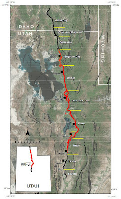
For reference, here's the USGS earthquake hazard map.

Memphis, Tennessee
Memphis lies within the earthquake hazard risk area of the New Madrid Seismic Zone, which is why it is one of the top cities in the U.S. for earthquake risk. According to the USGS, a magnitude 6.0 or greater earthquake has a 25–40% probability of striking the area within the next fifty years.
New York City, New York
Some people are surprised that New York City has an earthquake risk. Although the area isn’t as seismically active as Los Angeles, there are faults all over—or, more accurately, all under—the area. Historical evidence suggests a moderate quake of at least 5.0 should shake the area about every hundred years. The last one to strike was in 1884.
A 5.0 isn’t going to cause epic destruction, but it’ll do plenty of damage. Estimates for a 5.0 quake in New York City predict $39 billion worth of damage and over 30 million tons of debris. The already congested roads will become littered with rubble from brick and stone buildings, making it almost impossible for first responders to quickly reach those in need. Public transportation will be at a standstill.
Subway tunnels will also be hit. Traveling through soft riverbed mud and hard bedrock, the shaking will cause different segments to shake at differing rates. With parts of the tunnels—particularly the Steinway Tunnel, a 1.3-mile cast-iron tube deep below the East River—being built before earthquake codes, moderate shaking will likely cause major problems.
But while a 5.0 may be what the local faults are capable of, much more damage is possible. The Ramapo Fault stretches 185 miles, from Hudson Highlands through New Jersey and Pennsylvania, and it could produce a 7.0 earthquake. If a 7.0 were to strike, it’d do more damage than Superstorm Sandy or the tragic events of 9-11. This large earthquake would likely collapse, or severely damage, the 6,000 unreinforced masonry buildings in the New York City area.
In addition, potential disaster could result from the nearby Indian Point Energy Center, a nuclear power plant in Westchester County. The U.S. Nuclear Regulatory Commission (NRC) required extensive seismic evaluations to be performed at all U.S. nuclear plants following the Fukushima, Japan, disaster in 2011. A formal request was sent to the NRC that the Indian Point Energy Center be waived from the requirement, as it’s slated to close in 2021. How well the nuclear plant would fare in a 7.0 earthquake is unclear. However, a nearby large natural gas pipeline may be more susceptible to damage and, possibly, explosion in the event of a large earthquake. Such an explosion could trigger a disaster at the power plant like Fukushima.
Oklahoma City, Oklahoma
The heartland of the United States isn’t known for earthquakes, yet when you look at the USGS earthquake hazard maps, Oklahoma has a seismic target on it. Prior to about 2009, the state only experienced a few minor tremors every year. Since 2009 (at least through 2019 when I completed the research for my book) the state has a few almost every day. Much of the increased risk is blamed on induced seismicity, as a result of hydraulic fracking and wastewater injection. Fracking is the injection of high-pressure water, sand, and chemicals into deep rock, where the rock is broken up to release trapped gas and oil.
A seismicity risk report for 2017 stated, “The chance of damage in the next year [2017] from induced earthquakes is still similar to that of natural earthquakes in high‐hazard areas of California” (2017 One-Year Seismic-Hazard Forecast for the Central and Eastern United States from Induced and Natural Earthquakes).
While the number of earthquakes has appeared to decrease over the last year, the risk is still significant. Oklahoma’s capital city, Oklahoma City, has about 3 million people living in the area. Combined with many older unreinforced masonry structures, the risk for damage and injury is high as a result of the increased earthquake risk.
The biggest earthquake recorded in the state was a magnitude 5.8 near Pawnee in September 2016. A 5.0 temblor occurred in November of that year as well.
From 2010 to April 2018, Oklahoma experienced 2,724 earthquakes of magnitude 3.0 or higher. The year 2015 had the most at 903. Prior to 2009, the normal average was one or two magnitude 3.0 or larger quakes per year. As more regulations were put into place, and many operations moved to shallower depths, the number of earthquakes has appeared to be decreasing (Oklahoma Suffers Its 2,724th Earthquake Since 2010).
And Oklahoma isn’t the only place where fracking has caused earthquakes. Texas, Kansas, Colorado, and Arkansas have experienced fracking-linked quakes. In March 2014, a fracking operation in eastern Ohio triggered a magnitude 3.0 earthquake. That quake was on a hidden fault. Before that tremor, no quakes had been recorded in that region (Fracking Led to Ohio Earthquakes).
It’s generally believed that deep fluid injection from fracking operations only enhances seismic activity limited to the area where the fluid is injected into the ground. However, researchers at Tufts University found evidence to support the hypothesis that deep wastewater injections may potentially cause damaging earthquakes further away. These injections can affect deeper and larger faults that are under greater stress and more susceptible to fluid-induced slipping (Study suggests earthquakes are triggered well beyond fluid injection zones).
The following figure is from the U.S. Geological Survey on their induced earthquakes page. The long-term average is approximately 25 earthquakes of magnitude 3.0 or larger per year. Over a 35-year period (1973 to 2008), 852 earthquakes of magnitude 3.0 or higher were recorded. The next nine years (2009 to 2018) saw a huge increase of 3,514 magnitude 3.0 or larger earthquakes. Most of those earthquakes appear to be induced by nearby fracking operations.

Portland, Oregon
While not at the same risk as Seattle, Portland is along the Cascadia Subduction Zone, and it is now estimated to have a 17 to 20 percent chance of an 8.0 earthquake over the next 50 years. Previously, its estimate was only a 12 percent chance (A Major Earthquake in the Pacific Northwest Looks Even Likelier).
Portland not only has the risk of the Cascadia Subduction Zone but the Portland Hills Fault, which runs under the city. While earthquake damages and losses from a Cascadia rupture are significant, an earthquake on the Portland Hills Fault could easily double the losses.


Comments
Post a Comment