Earthquake Hazards: Liquefaction
With the focus on earthquakes so often on the shaking and potential infrastructure and building damage, there are other hazards the shaking causes that are sometimes overlooked or minimized. One of those hazards is liquefaction.
Liquefaction is one of the earthquake hazards I'm more concerned about where I live because according to the liquefaction-potential maps, my home is in an area with high liquefaction probability.
So, what is liquefaction?
When soil is saturated, or partially saturated, it can act like a liquid when it is sufficiently agitated or shaken (like, by an earthquake). Loose sand and silt-based soils are most susceptible.
As the earth shakes, the soil loses its strength and stiffness and begins to behave more like a liquid, where anything on the surface could sink or move. Even the liquefaction of buried layers of soil can cause these problems.
As a side note, one of the parables taught by Jesus in the New Testament (Matthew 7:24-27) was about a wise man building his house on a rock, and a foolish man building his house on the sand. In the parable the rains and floods came and caused the house built on the sand to fall.
Well, the same can happen in an earthquake. Buildings not built over a solid subsurface (like bedrock) are much more susceptible to the effects of soil liquefaction.
Effects of liquefaction include:
- loss of the soil’s ability to support structures;
- lateral spreading, as the ground over a buried liquefied layer could slide down a gentle slope;
- sand boils that can be ejected from a buried liquefied layer, forming sand volcanoes, with nearby ground settling and fracturing;
- flow failures can occur down steep slopes, resulting in a large displacement of material, much like a landslide;
- ground oscillation, which happens when the surface layer is shaken back and forth over a buried liquefied layer, resulting in the possible deformation of the surface;
- flotation may occur as light objects buried in the ground, such as pipelines and sewers, can float to the surface when surrounded by liquefied soil; and
- settlement can occur when the liquified ground surface settles or subsides after the shaking stops and the ground becomes firm again, which is particularly bothersome if your car, or other object, had sunk into the ground.
The good (or bad) news is liquefaction is more likely to occur in prolonged periods of ground shaking. It's unlikely a short quake will cause much, if any liquefaction.
However, there is no definitive time minimum of how long the ground must shake before liquefaction occurs. Ground composition (what's in the ground), soil saturation (how much water/moisture is in the ground), and other conditions can all play a role in how quickly, or slowly, liquefaction occurs.
 |
| Magnitude 7.5-7.6 quake in Niigata, Japan, 16 June 1964 caused liquefaction |
An earthquake with moment magnitude of about 7.6 struck Niigata, Japan, on 16 June 1964. The epicenter was about 31 miles (50km) north, with the hypocenter about 21 miles (34km) deep. The poor sub-soil conditions led to extension liquefaction across the city. Much of the city was built on unconsolidated sand and deltaic soil deposits from the Shinano and Agano rivers. The perceived intensity was about VIII (severe). Eyewitnesses of the Showa bridge collapse reported the failure started about 70 seconds after the earthquake started. Lateral spreading from liquefaction under the bridge piers is considered the main cause of the collapse.
The Niigata quake also caused fires and flooding, with most of the flooding from some tsunamis/

 |
| Liquefaction caused road damage. Martin Luff, 5 Sep 2010. https://creativecommons.org/licenses/by-sa/2.0/deed.en |
 |
| St Andrews College, Papaui Road liquefaction. Tim, 22 Feb 2011. https://creativecommons.org/licenses/by-sa/2.0/deed.en |
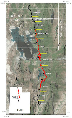
The United States Geological Survey (USGS) has various earthquake hazards maps, including liquefaction maps. The USGS, various state agencies, universities, and other organizations have identified areas at greatest risk of liquefaction. Many liquefaction potential maps are available online, if you’re interested in knowing what your risk is.
 |
| Liquefaction potential for part of Salt Lake County, Utah. https://geodata.geology.utah.gov/pages/view.php?ref=12771 |


Comments
Post a Comment