Eastern Regional Earthquake Risk in the U.S.
The eastern earthquake risk in the United States may not be as high as other regions, but it still exists. On August 9, 2020, a magnitude 5.1 earthquake struck two miles southeast of Sparta, North Carolina. It was the largest to hit the region since a 5.2 in the Great Smoky Mountains in 1916. It was strong enough to shake off items from store and home shelves, but there were no deaths or injuries reported. At least four foreshocks of magnitudes 2.1 to 2.6 occurred in the preceding 25 hours.
Earthquake Risk on the East
In 2011, a magnitude 5.8 earthquake struck central Virginia. It was an unexpected tremor, and the strongest to hit the eastern United States since 1897. People felt the quake from Florida to southeastern Canada, and as far west as Wisconsin. Some estimated almost a third of the U.S. population felt it. One reason it was believed to be felt over such a wide area is the underlying ground structure, where the type, age, density, and even temperature or the underlying rocks of the eastern United States transmit seismic waves more efficiently than in the western states.
Analysis of the quake indicates that the eastern U.S. cities are at a greater risk of being affected by earthquakes than previously estimated. It was also noticed that “an unusually high fraction of the seismic energy radiating from [the 2011] quake was directed towards the northeast, where several major population centers lie, along the network of faults in the region” ( Virginia earthquake wins by a landslide).
Earthquakes in the eastern region of the United States are felt more widely than those on the west because the seismic waves travel through the colder, denser crust much further. The following image is public domain, retrieved from https://www.usgs.gov/media/images/central-virginia-earthquake-comparison-map

There is sufficient documented evidence to suggest the need to revise the established distance limits for the occurrence of landslides in different tectonic environments
Rockfalls and landslides from the M5.8 quake were triggered “at distances four times greater and over an area 20 times larger than previously documented for M-5.8 earthquakes worldwide” (2011 Virginia quake triggered landslides at extraordinary distances). Previous studies estimated a quake of that size should only trigger landslides up to 37 miles (60 kilometers) away. But, that quake set records by causing landslides at least 152 miles (245 km) away. In the linked article the two USGS authors (Randall W. Jibson and Edwin L. Harp) state, "There is sufficient documented evidence to suggest the need to revise the established distance limits for the occurrence of landslides in different tectonic environments."

Largest Eastern U.S. Earthquake
The largest recorded earthquake on the east coast was an estimated 6.9 to 7.3-magnitude tremor that occurred in 1886, striking Charleston, South Carolina, and killing at least 60.
In 1755, an estimated 6.0 quake hit Boston. A magnitude 6 struck Cape Ann, Massachusetts, in 1755.
A 5.0 in 1737 and 5.3 in 1884 struck near New York City. More recently, a 5.8 tremor rocked the northern part of New York in 1944.
While these magnitudes aren’t really large earthquakes, they can cause significant damage particularly to older buildings. In both Boston and New York City there are many structures built with unreinforced masonry. While New York City is built mostly on bedrock, Boston has it worse where much of the city is built on artificial fill, which can amplify seismic waves by as much as three times (Background on: Earthquake insurance and risk).
Eastern Seismic Zones
Like the central U.S., the east has seismic zones. Some of these include the East Tennessee, Central Virginia, and Charleston/South Carolina Seismic Zones.
The issue with earthquakes in the eastern U.S. is their rarity. The problem with establishing a historical record is our record only goes back about 400 years. Accurate measurements of earthquakes only go back about 100 years. So, our knowledge about east coast quakes comes from large events that were noticed, and recorded, by people in the area.
Unlike the west coast, there aren’t active tectonic events such as subduction zones, collisions or spreading in eastern North America. Where faults in California might have recurrences measured in decades or centuries, we don’t know the intervals on the east. There may be thousands, hundreds of thousands, or even millions of years between major events (Are Big Earthquakes a Concern for the Eastern United States?).
What if a big earthquake, even in the mid-to-upper magnitude 6-range struck? Considering the aging infrastructure and many structures not built to be seismically resilient, there could potentially be enormous destruction. The 1866 earthquake in Charleston did not have any previously known earthquakes in the region.
Like many other parts of the country, residents on the east coast need to become better prepared. Many should be prepared for hurricanes (although most are not), and it’s not much more of a step to become prepared for an earthquake.
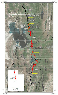
The following image is of the Central Virginia Seismic Zone. Red circles indicate epicenters of quakes since 1973 and some notable earlier quakes.


Comments
Post a Comment