Earthquake Early Warning
People have been trying to predict earthquakes as long as earthquakes have been happening.
Some claim to have dreams or visions that predict an earthquake, but this is a bit unreliable especially pertaining to when and where.
There have been some scientific studies regarding earthquake prediction but these have primarily related to analyzing data that was gathered prior to earthquakes. This is hit and miss because often the data desired was collected because nobody knew it would be needed. And that's the other issue, what data is needed, if it's actually possible to predict earthquakes.
A few of the somewhat predictors are foreshocks, earthquake swarms, and possible earthquake lights. These, along with some other promising and interesting studies, warrant their own posts on another day.
So, while predicting an earthquake hours or days in advance is still something we'd love to have, there are ways in some parts of the U.S. and other countries that you can get an "advance" notification of an earthquake.
Although not an earthquake prediction--that is identifying when and where an earthquake is to hit before it happens--these earthquake early warning systems use base station monitoring systems and mobile devices to let users know an earthquake has started and to expect shaking.
The earth shaking may seem like an obvious indicator of an earthquake, but before the damaging, and slower S-waves strike sensitive systems can detect fast-moving P-waves. It's this early detection that is used to give you a 20-60 second heads up...or heads quickly moved to a safe place.
The following are not all-inclusive, just a few apps I've looked into.
ShakeAlert® Earthquake Early Warning App
Several phone apps are either available or in development whose main goal is to provide an early warning of an earthquake. Many of these apps are based on an earthquake early warning system called ShakeAlert®, which is being developed and tested by the USGS and several state and university partners. The warning is based on the early detection of fast moving “P-waves” before the more damaging, and slower, S-waves arrive.
The ShakeAlert system is primarily for the west coast of the United States, and these early warning apps may give you a 20-60 second warning. But you can do a lot to better protect yourself with a 20-second or more warning. Even 20 seconds can allow a complex medical operation to stop, sensitive industrial processes to halt, allow elevators to move to the nearest floor, and provide time for schools and public areas to issue alerts so people have a chance to move into a safer position.
The West Coast ShakeAlert Earthquake Early Warning System began its phase 1 testing in California, Oregon, and Washington in the fall of 2018. Version 2.0 went live and included two new messages. The first, original, message is an Event Message, and the additional messages include a Contour Message and Map Grid Message. The Event Message includes information about the earthquake source, location, magnitude, and uncertainty. The Contour and Grid Map messages include a nested 8-point polygon map and a 12 mile (20 km) spacing grid map of the projected affected area.
Phase 1 was rolled out to a number of commercial and institutional users, and the system will eventually be phased into a full public alerting system. Technical improvement and increased sensors are being deployed, with initial target areas being Los Angeles, the Bay Area, and the Seattle metro region.
In January 2019, about 50 percent of the sensor system was completed. As the speed and scale for mass alerting becomes available for more effective warnings it will be rolled out for broader public alerting of magnitude 5.0 and higher events, along with educating the public about the system.
More information about the system can be found at ShakeAlert.org.
If you live in an area supported by earthquake early warning apps, the extra 20-60 seconds of warning can be helpful in getting yourself (and others) ready for the coming earthquake.
The USGS’s ShakeAlert system has been in development since 2006, but funding cuts have delayed the project. On January 3, 2019, Los Angeles Mayor Eric Garcetti announced the release of ShakeAlertLA, which only works for L.A. County (L.A.'s Public Earthquake-Warning App is First in the U.S.).
When ShakeAlertLA was rolled out, there was a lot of discussion about where to set the notification threshold. The decision was to notify users if the detected tremor was at least a magnitude 5.0 and expected to produce “light” shaking (level 4 on the Modified Mercalli Intensity Scale) for those in Los Angeles.
On July 4 and 5, 2019, magnitude 6.4 and 7.1 earthquakes hit Ridgecrest, about 122 miles (200 km) north-northeast of Los Angeles. ShakeAlert generated a message 6.9 seconds after the first shaking, but users in Los Angeles didn’t receive any alert. The reason was because while the magnitude met the notification requirements, the predicted shaking for Los Angeles did not.
In Ridgecrest the shaking intensity was a level 8, which is considered severe and can cause damaged to ordinary structures, and considerable damage to poorly built ones. However, the Los Angeles area was not expected to have more than a level 3, and most of the county didn’t experience much more than window blinds swaying or pools sloshing (L.A.'s ShakeAlert earthquake warning app worked exactly as planned. That’s the problem).
Even though the system performed as it was expected to, the public backlash in not receiving the earthquake notification caused officials to lower the threshold to magnitude 4.5 or greater with an intensity level of 3 or more. The fear is this lower notification might make people become complacent when they start receiving too many alerts.
Phase 3 is now being implemented

QuakeAlert Earthquake Early Warning
A similar product called QuakeAlert can also provide early warnings. Developed by Early Warning Labs, who has partnered with the USGS, this app also uses the P-waves to predict where the damaging S-waves are likely to strike. The app’s cloud server “calculates the individual alerts for all users with personalized time to shaking and intensity” (Early Warning Labs).
With this information, QuakeAlert provides an expected arrival time of the earthquake, its expected intensity, how far you are from the epicenter, the magnitude of the quake, and suggested safety measures to take. As of this writing, the app is still in beta testing and users can sign up for access at the website.
SkyAlert and MyShake Early Warning Apps
A third company is developing a similar early warning product. Called SkyAlert, the technology has been “evolving for years in Mexico” (A 30-Second Earthquake Warning Gives a Menlo Park Fire Station a Chance to Protect Itself). The company is designing the system to not only provide emergency notifications, but also to be used with various internet connected (Internet of Things, or IoT) devices. The SkyAlert system has been integrated with the USGS ShakeAlert warning system.
There are other companies and organizations also developing early warning tools and applications. However, most are geared towards companies as app-based products targeting individual users “aren’t going to bring in enough dollars to support a business”.
One exception is the UC Berkeley Seismology Lab, which has developed, and is continuing to develop, a free app called MyShake for Android devices and MyQuake for Apple iOS users.
http://earthquakes.berkeley.edu/myquake/
I only recently discovered the MyShake app so I haven’t had any experience with it, although I installed it on my smartphone.
A big difference between the UC Berkeley project and others is MyShake doesn’t rely on expensive, specialized equipment for detecting earth tremors. Instead, it uses a sophisticated computer system (an artificial neural network) to collect, compare, and analyze motion sensors from smartphones. The MyShake system then determines whether the data matches the model of an earthquake or gets filtered out as normal phone movement. Testing has shown that smartphones can be used to detect earthquakes as small as magnitude 5 and within nearly 4 miles (10 km) of the epicenter. The app also gives notifications of earthquakes reported by the USGS.
UC Berkeley is also piloting the ShakeAlert program, and looking to integrate it into the MyShake system, which would provide users with early warning notifications.
Earthquake Reporting Apps
As for phone apps that just notify you when an earthquake happens, there are a lot. I've only used a few.
The one I like is called LASTQUAKE, and it’s the official earthquakes app of the European-Mediterranean Seismological Centre (EMSC). There are times when I’ve seen it report earthquakes much earlier than the USGS website. I downloaded and installed it from the Android Play Store.
As a disclosure, I don’t hold any financial interest in any early warning app. Unless otherwise mentioned, the apps I've mentioned were free as of my writing this.
For those interested, for earthquake notifications I'd recommend LASTQUAKE and MyShake apps. LASTQUAKE has been a little more user-friendly and MyShake seems to report more frequently. You can set preferences for earthquake magnitudes.
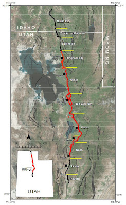
If you live in an area supported by earthquake early warning apps, the extra 20-60 seconds of warning can be helpful in getting yourself (and others) ready for the coming earthquake. Unfortunately there are currently no early warning apps that provide notice for the area I live in, near the Wasatch Fault in Utah.


Comments
Post a Comment